By Headwater Holidays Team | Last updated: 29 January 2026 | Reading time: 6–10 minutes
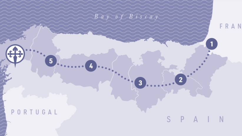
Camino Francés is roughly 752 km, starting from Saint-Jean-Pied-de-Port and finishing at the cathedral in Santiago. Our Headwater Camino Francés itinerary splits this journey into 42 nights, with the option to extend with additional nights between the set stages. Average daily distances often range from 20–25km, plus additional nights at the start and end for travel.
Many walkers choose to approach the French Way in stages, allowing time to savour each region in turn. Popular one- or two-week sections include Saint-Jean-Pied-de-Port to Logroño, Logroño to Burgos, Burgos to León, León to Sarria, and the final Sarria to Santiago stretch. All of which can be combined to create a complete pilgrimage over several trips.
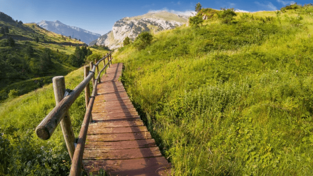
Expect a mix of gravel paths, farm tracks, quiet lanes and some asphalt near towns. Steeper sections include the Pyrenees, Montes de Oca, Cruz de Ferro/Foncebadón and the ascent to O Cebreiro.
Best windows are spring and autumn for milder temperatures and fewer crowds. Summer offers long days but can be hot across the Meseta.
“What makes the Camino Francés extraordinary is the contrast: mountain trails above Saint-Jean-Pied-de-Port, the big sky quiet of the Meseta, and that first glimpse of Galicia’s green hills after O Cebreiro. My favourite stretch is the climb to Cruz de Ferro at sunrise; simple, humbling and unforgettable. For most walkers, aiming for 22–24 km per day keeps the journey joyful rather than a slog, and booking characterful hotels with a bag transfer means you can savor evenings in towns like Burgos, León and Portomarín.”
Cecile, Route Expert & Headwater Camino Product Manager
From the first climb into the Pyrenees to the green hills of Galicia, the Camino Francés unfolds in a series of distinctive landscapes.
Your walk begins in the Basque foothills before the iconic climb over the Pyrenees to Roncesvalles, one of the most demanding yet uplifting days on the route. The descent through beech forest towards Pamplona then offers a gentler introduction to Spain, with welcoming villages and a growing sense of shared purpose among fellow pilgrims.
Leaving Pamplona, you’ll pass the pilgrim sculpture at Alto del Perdón, where wide views open across the countryside ahead. The path then winds through Navarra and into La Rioja, past medieval bridges, castles and vineyards, before reaching Logroño, renowned for tapas evenings in its atmospheric old town streets.
This stretch gently traverses La Rioja’s wine country and into Castile, with undulating farmland and traditional villages such as Nájera and Santo Domingo de la Calzada. The section ends in Burgos, where the magnificent Gothic cathedral and lively plazas invite you to linger and absorb the city’s rich history.
Crossing the Meseta brings a different kind of beauty: big skies, open fields and long, quiet tracks that many find deeply reflective. Small towns and Romanesque churches punctuate the plateau, before the route leads you into León, famed for its cathedral’s stained glass and Gaudí’s Casa Botines.
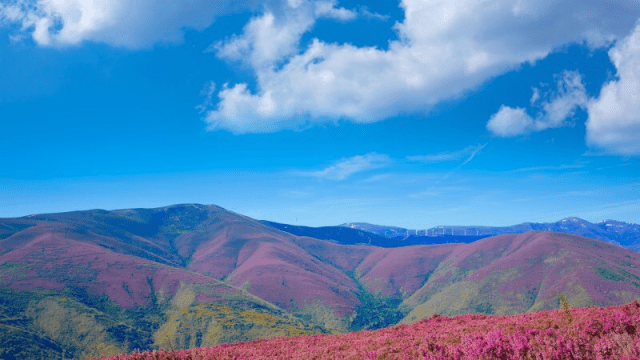
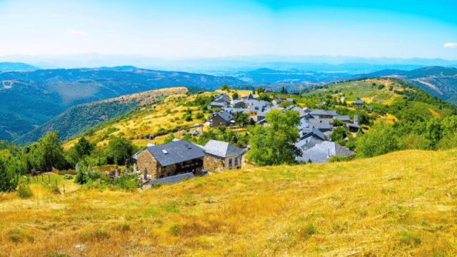
West of León, the Camino climbs into the Montes de León, passing Astorga and the emblematic Cruz de Ferro, where pilgrims often leave a stone as a symbol of their journey. From Ponferrada, dominated by its Templar castle, the way continues through El Bierzo’s vineyards and up to O Cebreiro, a mountain village with Celtic roots that marks your arrival in Galicia.
The final 100km leads through Galicia’s rolling hills, woodlands and hamlets, with stone-walled paths and wayside chapels guiding you towards Santiago. This is the liveliest part of the route, as pilgrims converge and share the anticipation of reaching the cathedral, where the sense of achievement is matched by an atmosphere of quiet reflection.
From the first climb into the Pyrenees to the green hills of Galicia, the Camino Francés unfolds in a series of distinctive landscapes.
For the full Camino Francés route with Headwater, allow 42 nights. For the Compostela, our itinerary is 7 nights from Sarria to Santiago, 117km.
Yes, collect at least two stamps (sellos) per day in the final 100 km on foot (or final 200 km by bike) to qualify for the Compostela.
Spring (April–June) and autumn (September–October) balance pleasant weather with services open and moderate crowds.
Burgos and León for cathedrals and culture; Logroño for tapas; Ponferrada for the Templar castle; Santiago at the end.
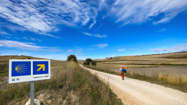
Yes, yellow arrows and scallop shells mark the way throughout, supported by the official guidebook, printed notes and the shared help of fellow pilgrims along the route.
This guide includes practical route notes and highlights from Cecile, Route Expert and Headwater Product Manager, covering the contrasts between the Pyrenees, the Meseta and Galicia, plus pacing tips for enjoyable daily distances.
